Walailak University (WU) is at the forefront of marine and coastal ecosystem conservation through cutting-edge research and technology-driven projects. Recognizing the urgent need to protect Thailand’s rich biodiversity and fragile ecosystems, WU collaborates with government agencies, local authorities, and industry partners to tackle key environmental challenges. From watershed and coral reef conservation to the protection of rare marine species, WU’s initiatives are strategically focused on ecosystem monitoring, restoration, and sustainable resource management.
Key projects, in 2023, include the Bandon Bay Project, which uses Geographic Information System (GIS) and Remote Sensing to monitor and prevent ecosystem degradation across this expansive watershed area. Additionally, a CTD Sensor Network has been established around coral reefs on Racha Island, providing real-time data to support coral conservation and mitigate threats from climate change. To study and protect vulnerable marine species, WU’s Aerial Survey Using UAV-Drone project monitors populations of dugongs, turtles, and dolphins in Krabi Province. Each research project work directly on advanced technology and collaborative efforts, underscoring WU’s commitment regarding marine industry to minimize or prevent damage to aquatic ecosystems in a body of water for current and future generations.
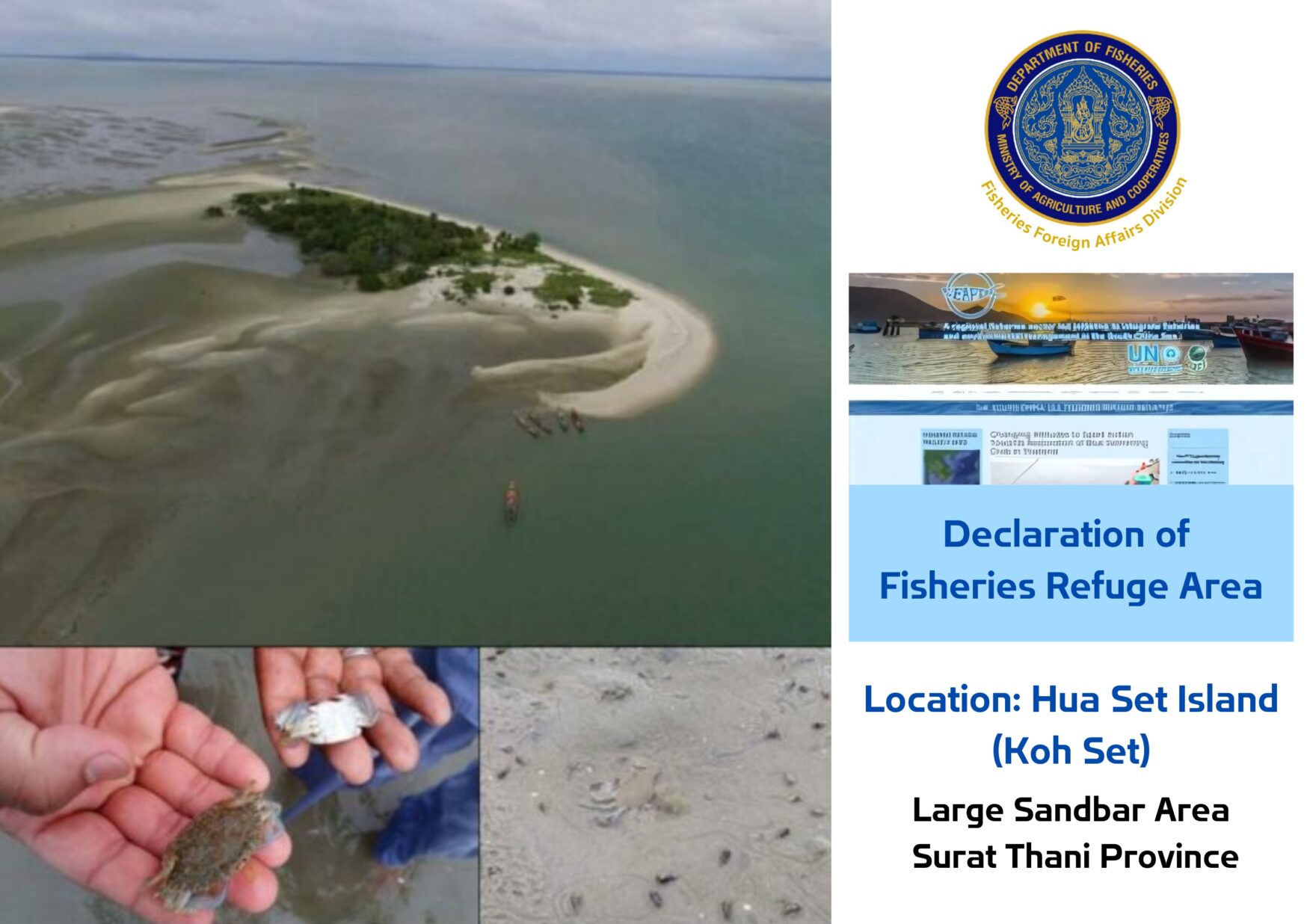
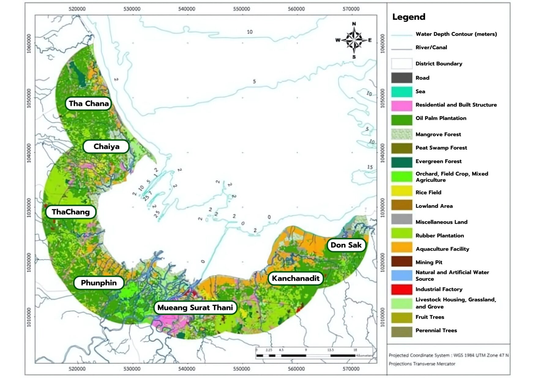
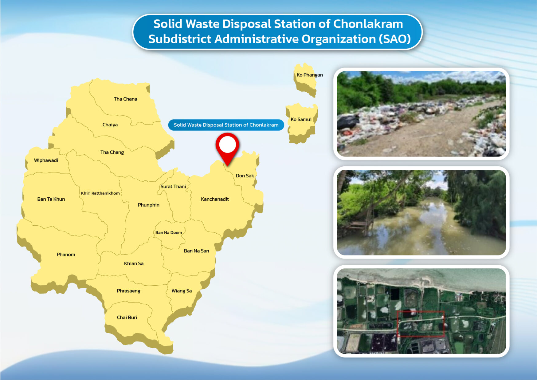
Bandon Bay, a vast watershed area near Walailak University, has become the focus of extensive research funded by the National Research Council of Thailand (NRCT) and ARDA. Researchers from Walailak University, government agencies, local authorities, and industry sector i.e., the Thai Frozen Foods Association (TFFA) have collaboratively conducted studies encompassing oceanography and ecology in Bandon Bay. This research aims to monitor water and sediment quality, assess fishing gear practices, and examine oceanographic data, as well as agricultural and industrial land use in surrounding areas.
In addition to preventing ecosystem damage, GIS and remote sensing are used to map spawning habitats, nursery grounds, and predict growth trends for marine life. This technological advancement supports proactive ecosystem management, helping to mitigate the impact of marine activities and ensuring the sustainable use of resources within Bandon Bay.
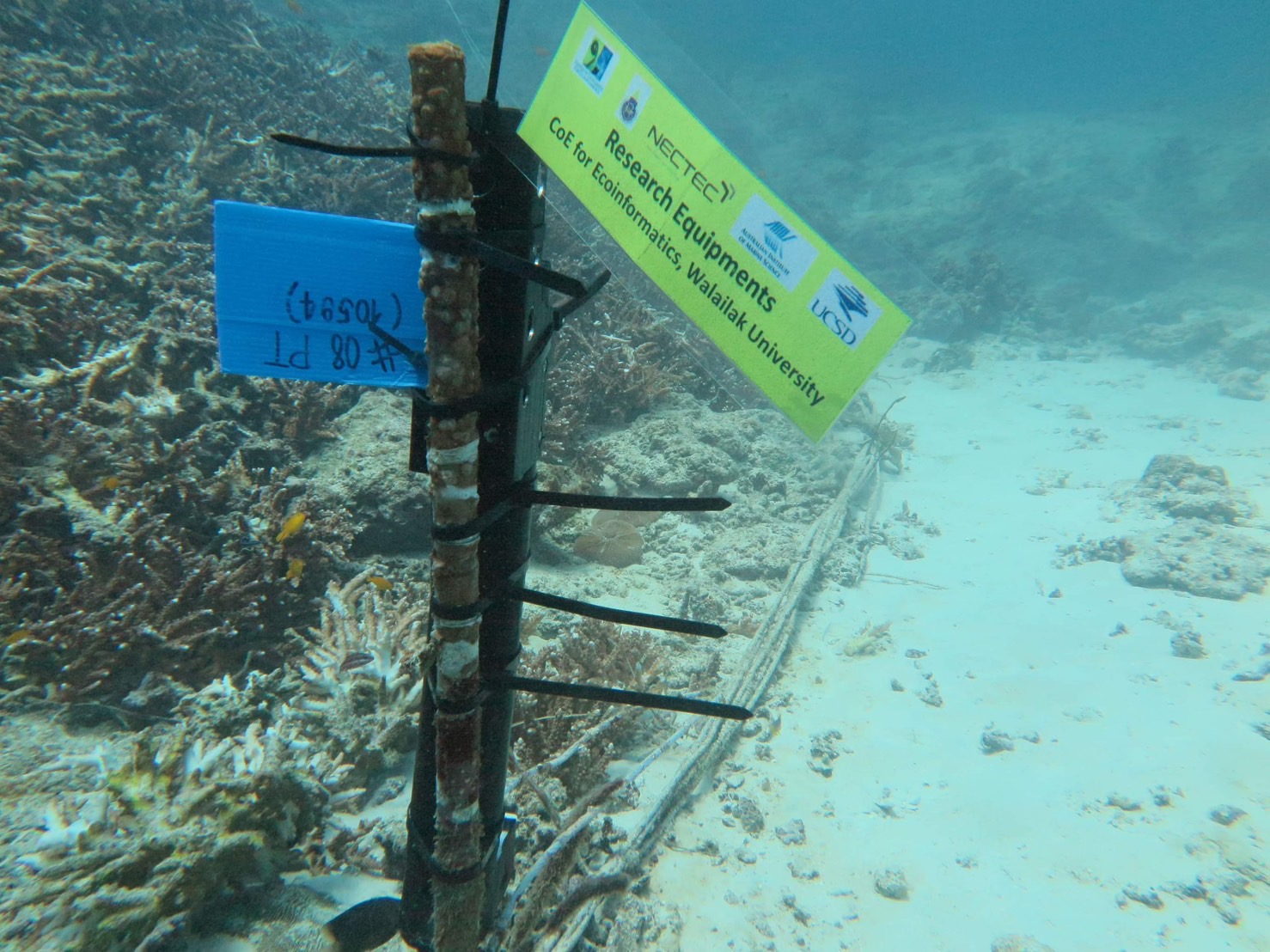
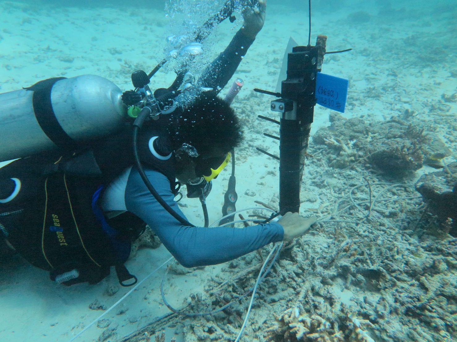
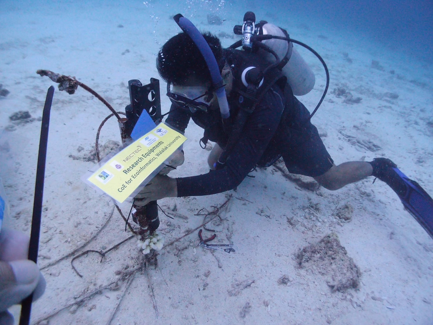
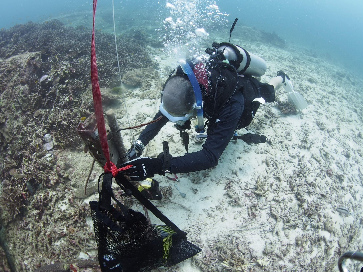
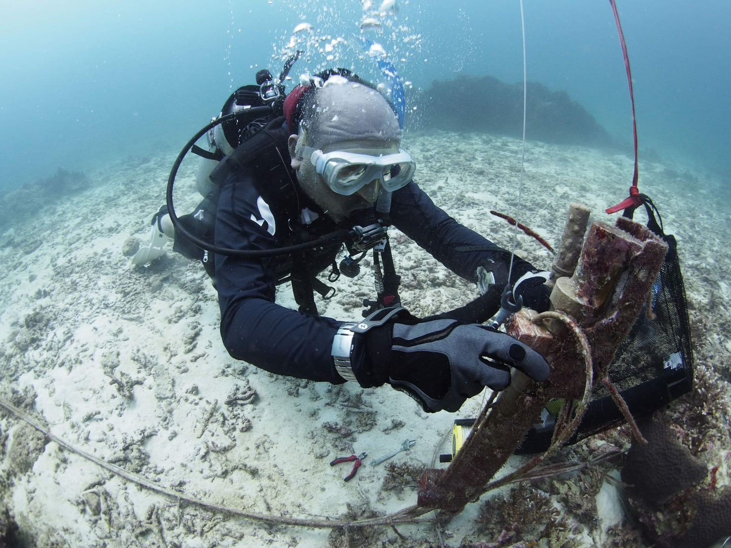
Thailand’s coral reefs in the Andaman Sea and Gulf of Thailand are vital to marine biodiversity, yet they face persistent threats from coral bleaching across numerous areas. Challenges in coral recovery are heightened due to the distance of locations like Phuket from Walailak University. To address these issues, Walailak University researchers implemented a CTD sensor network to monitor environmental conditions around coral ecosystems and support tsunami research on Racha Island in Phuket Province.
In 2023, the coral sensor network, established by placing Conductivity, Temperature, and Depth (CTD) sensors in Khon Khae Bay and Patok Bay, continuously tracks fluctuations in sea temperature, conductivity, and depth. Over time, the project expanded its scope to ensure comprehensive monitoring of environmental changes impacting coral reefs. The data collected through the CTD sensor network provides critical insights for environmental management and informs policymakers in developing strategies to prevent further degradation of coral ecosystems in Phuket Province.
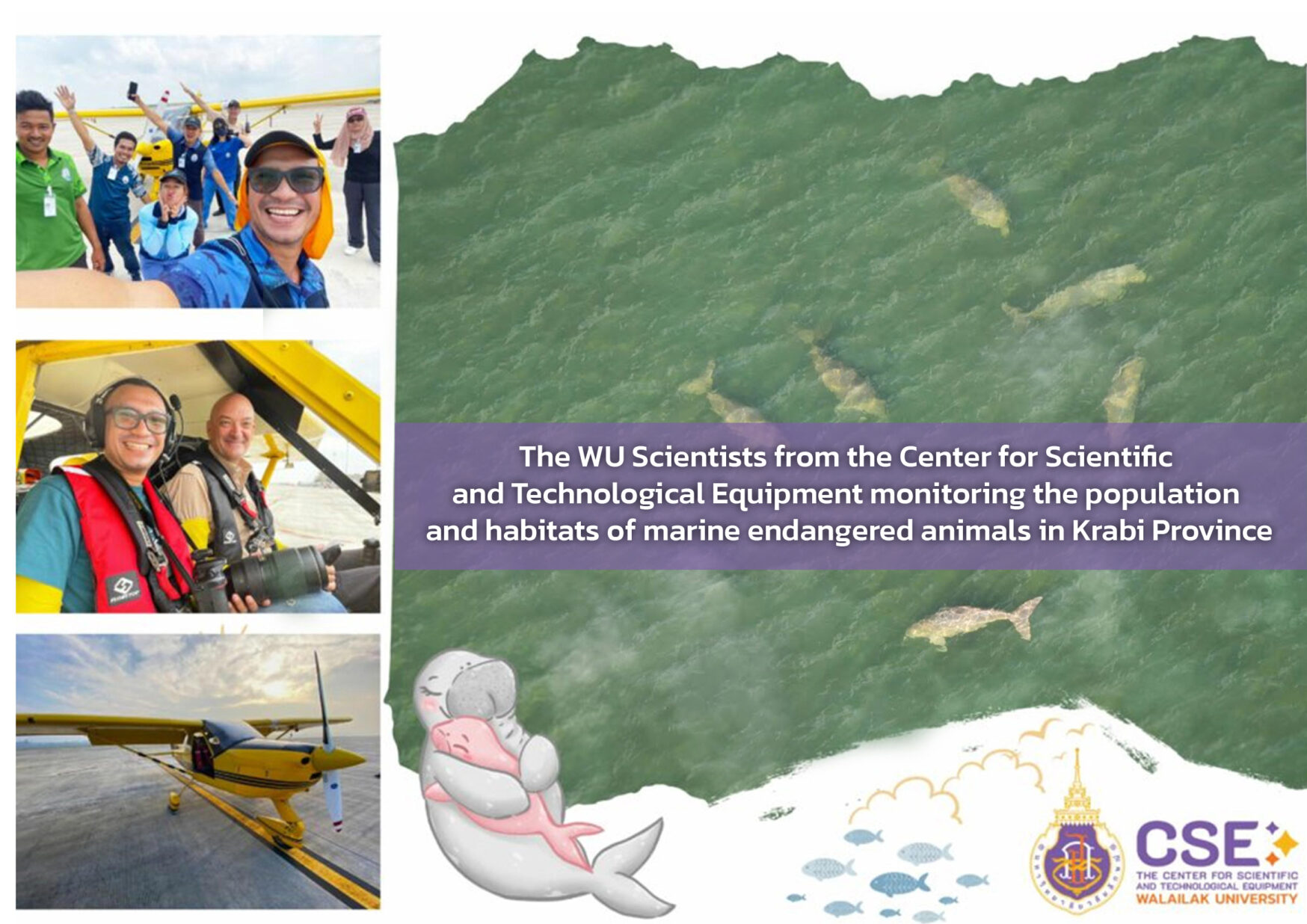
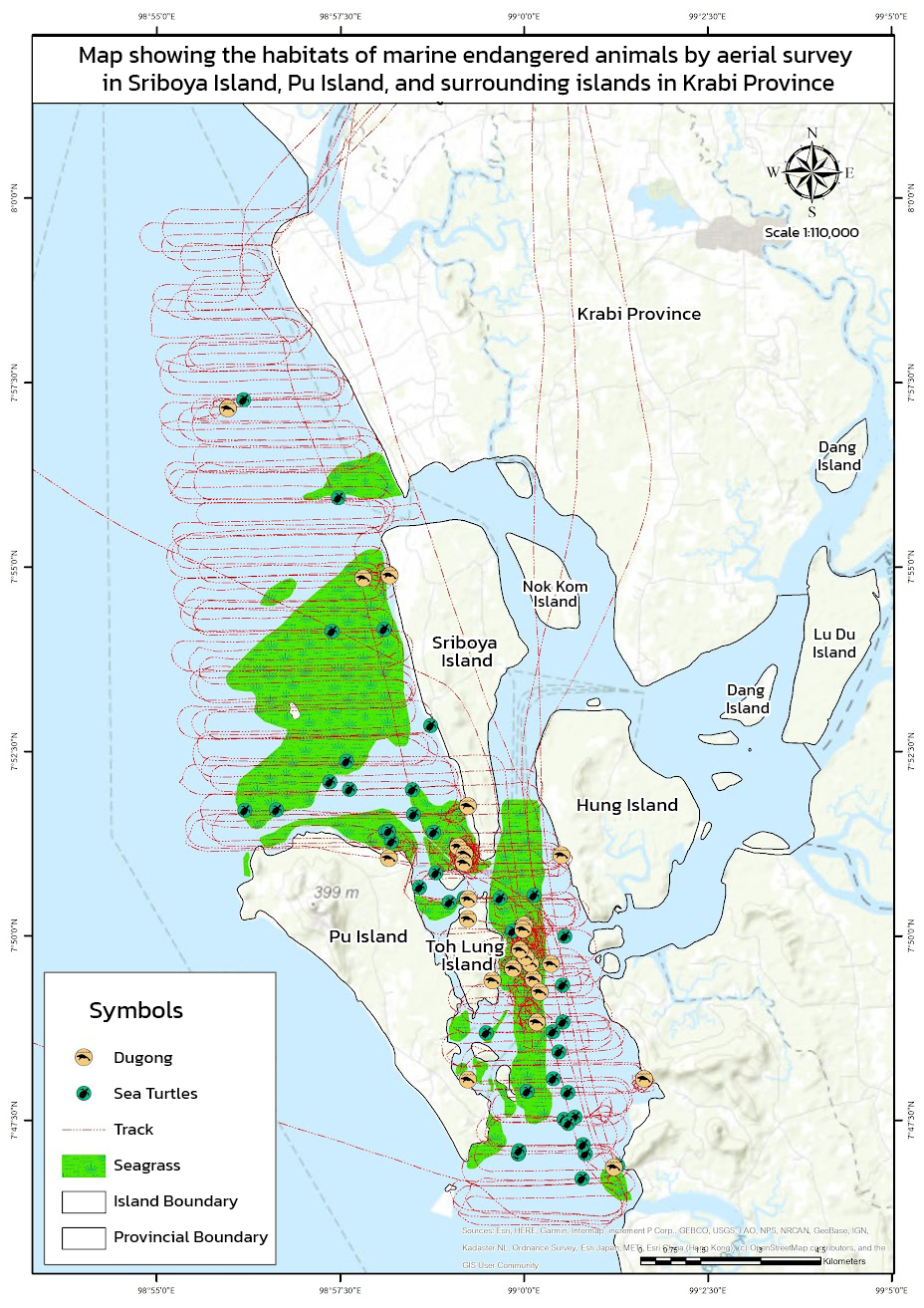
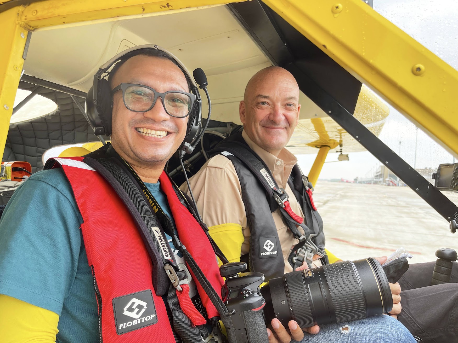
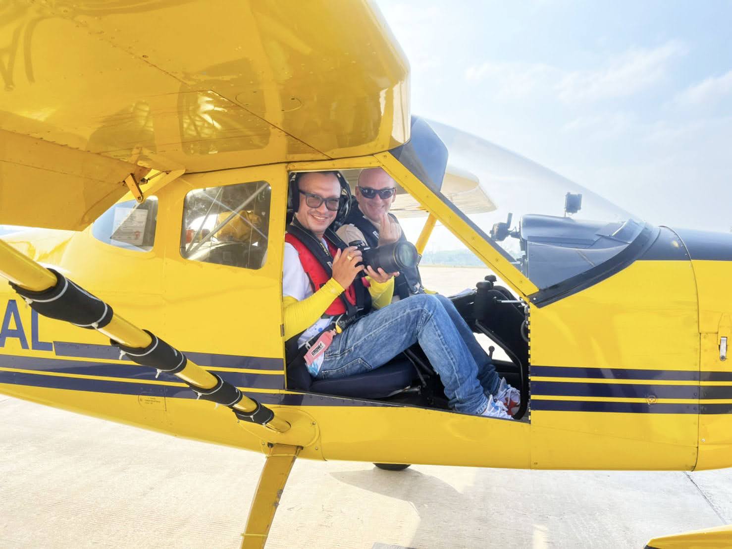
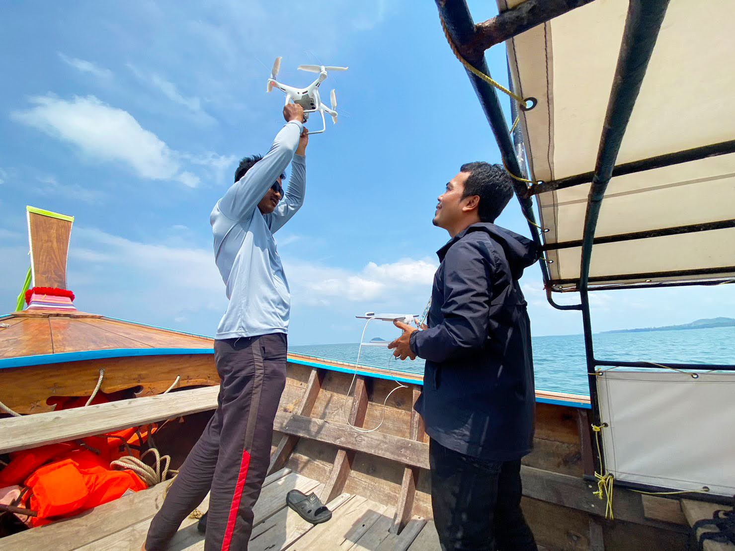
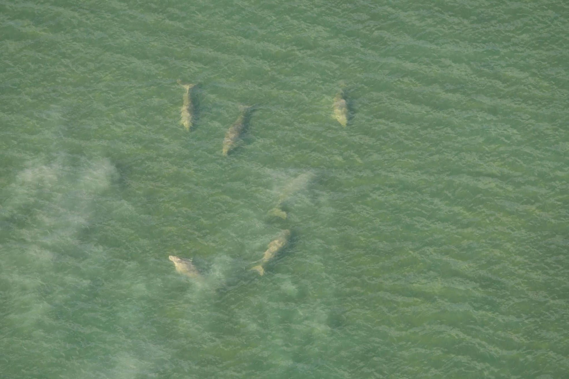
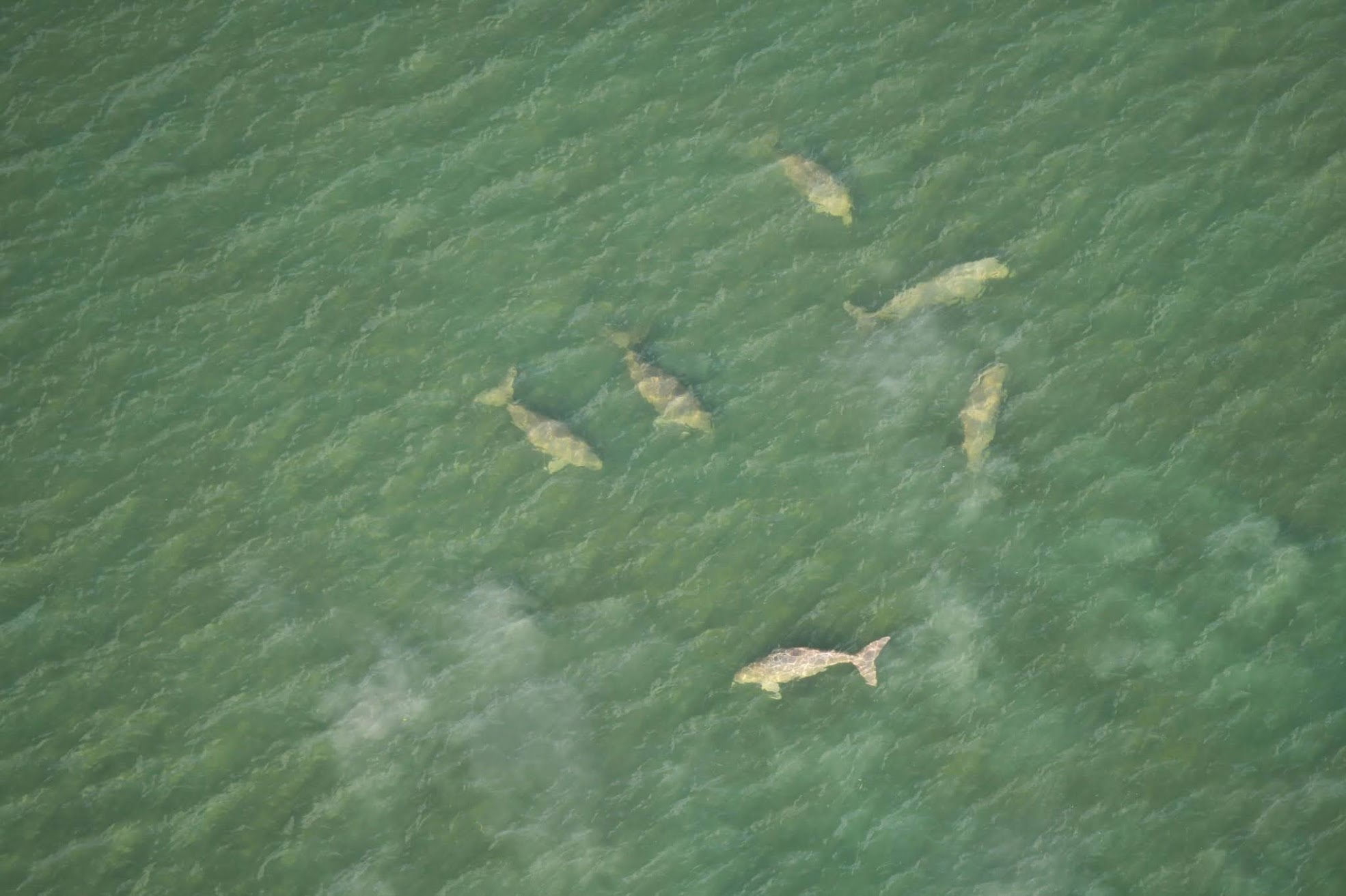
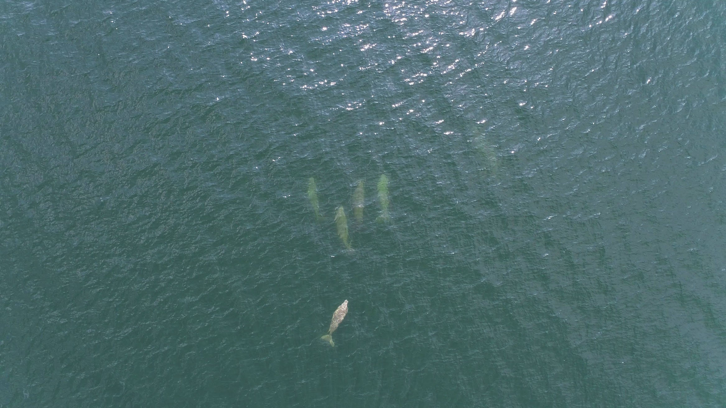
Scientists from the Center for Scientific and Technological Equipment at Walailak University have conducted extensive aerial surveys to study rare marine animals, under treated,in Krabi Province such as Dugong, Turtle, and Dolphin. This exploration is a collaborative effort involving Walailak University and the Marine and Coastal Resources Research Center (Lower Andaman Sea). Utilizing a two-seater fixed-wing aircraft and a line transect method, the team performed aerial surveys with the assistance of both local and international volunteer pilots. Unmanned aerial vehicles (UAV drones) were deployed for detailed water-based surveys around Koh Pu, Koh Sriboya, and nearby islands in Krabi Province.
The preliminary survey results identified 22 dugongs (including 3 mother-calf pairs) and 74 sea turtles. Health assessments based on visual observation revealed that the dugongs were displaying behaviors such as foraging along seagrass beds and engaging in mating activities. Additionally, the presence of mother-calf dugong pairs indicates a potential increase in the new generation of Dugong and sea turtle populations in the area.
Each year, Walailak University, through its faculty members, works closely with local communities to diagnose issues related to technologies or practices that enable the marine industry to minimize or prevent damage to aquatic ecosystems. This collaboration actively involves community participation in jointly addressing these issues through development initiatives. The approach integrates cooperation to build teamwork and ensure stakeholder engagement across all sectors. At the end of each year, the outcomes of these initiatives are assessed, the project’s success is measured, and plans are made for continued efforts in the following year. This shows the university’s ongoing work regarding technologies or practices that enable the marine industry to minimize or prevent damage to aquatic ecosystems. The initiatives have received high levels of acceptance and satisfaction from the community and beneficiaries.


