Technologies for Preventing and Minimizing Damage to Aquatic Ecosystems
In 2024, Walailak University collaborated with government agencies, local authorities, and marine industry partners to implement projects that provide advanced technologies to minimize and prevent damage to aquatic ecosystems.
Among these initiatives, the Bandon Bay Project employs Geographic Information Systems (GIS) and Remote Sensing to monitor and mitigate ecosystem degradation across this expansive watershed. The university also established a CTD Sensor Network around coral reefs on Racha Island, delivering real-time data to support coral conservation and address climate change-related threats.
To protect vulnerable marine species, the Aerial Survey Using UAV-Drone project monitors populations of dugongs, turtles, and dolphins in Krabi Province. Each project integrates cutting-edge technology with collaborative efforts, reflecting Walailak University’s commitment to sustainable marine industry practices and the protection of aquatic ecosystems.
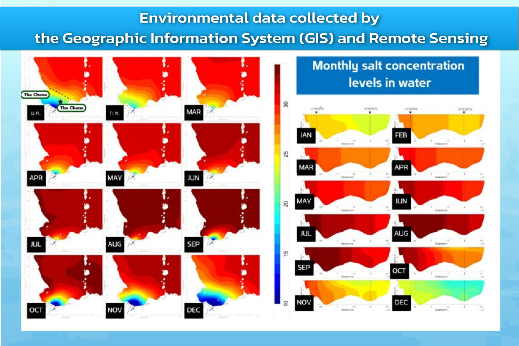
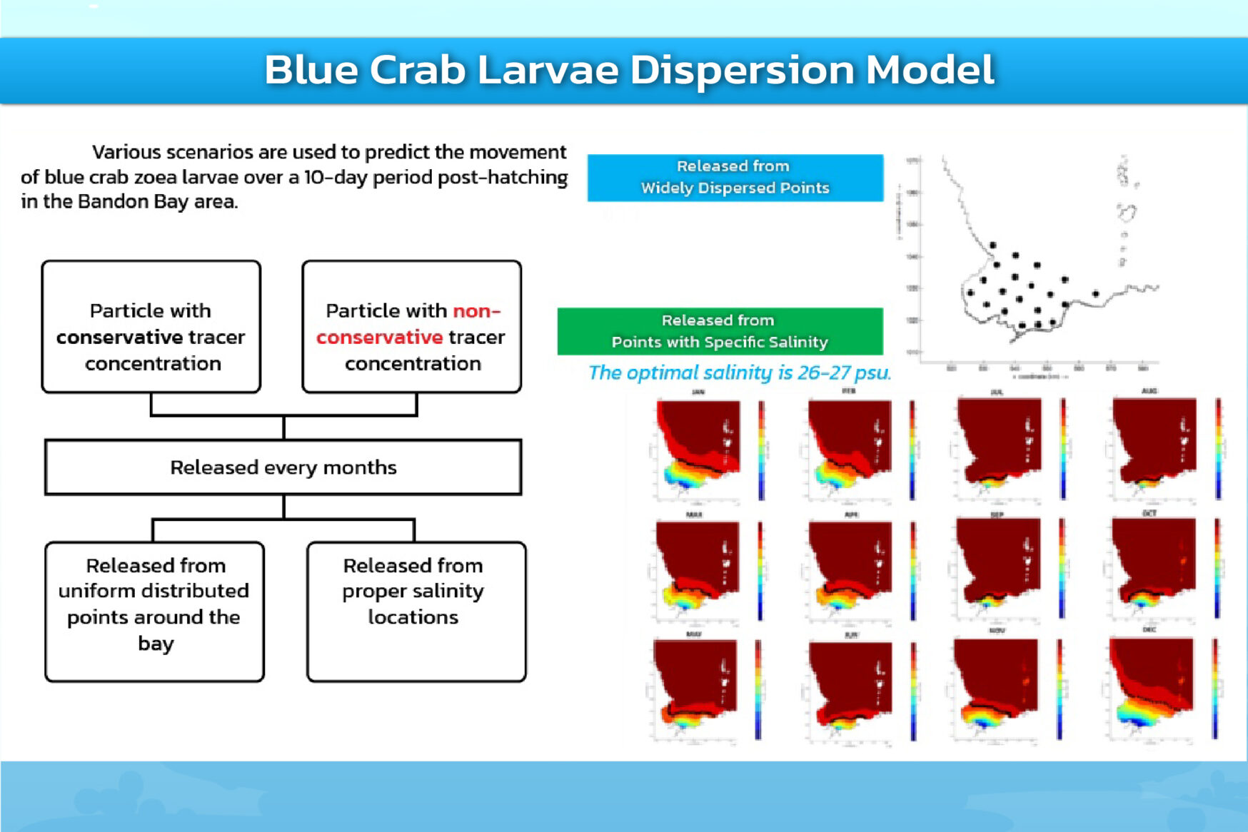
GIS and Remote Sensing Technologies for Monitoring and Preventing Ecosystem Destruction in Ban Don Bay
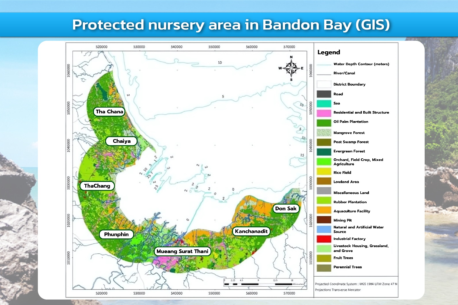
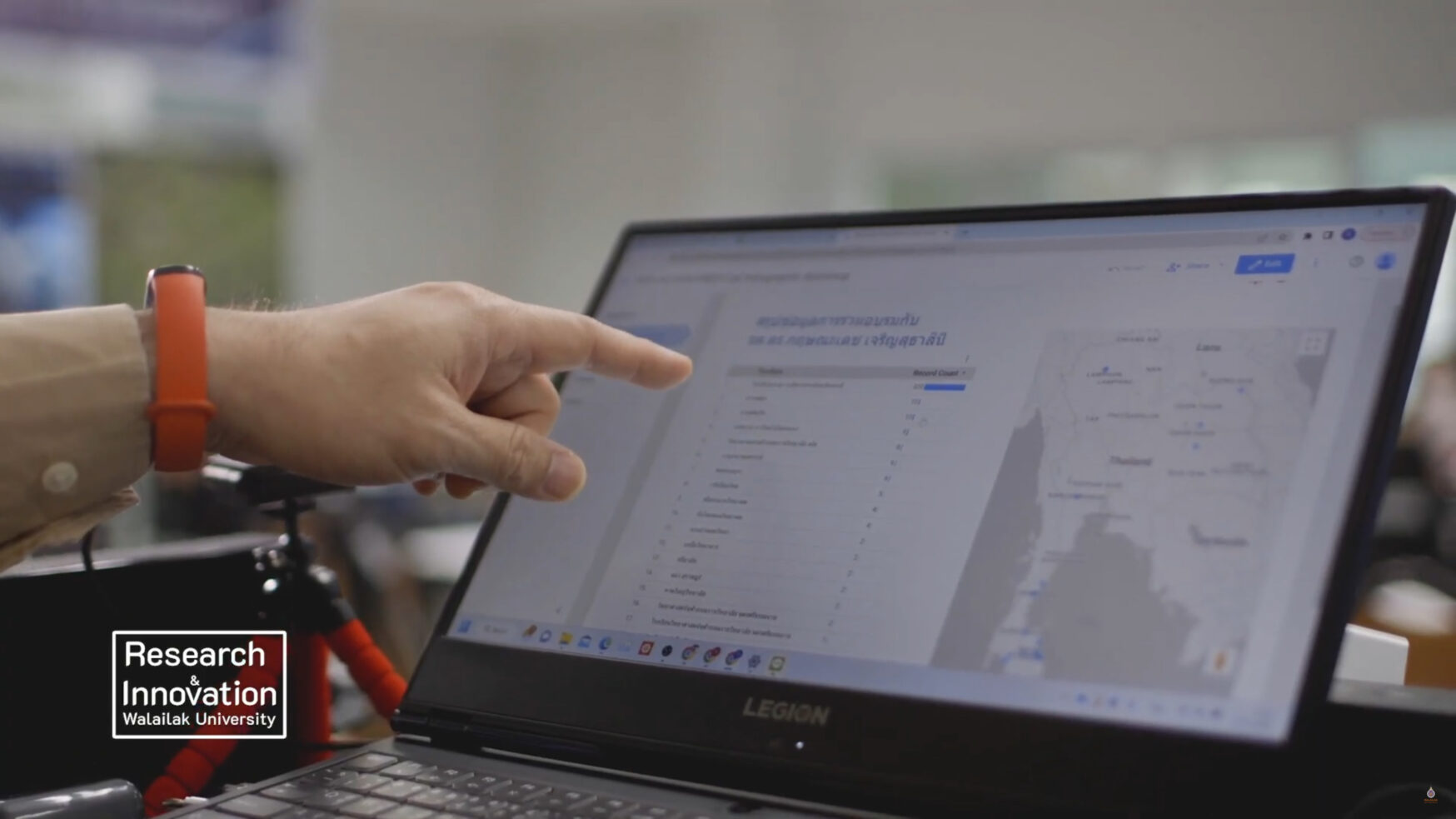
Bandon Bay, a vast watershed area located near Walailak University, has become the focus of comprehensive research supported by the National Research Council of Thailand (NRCT) and the Agricultural Research Development Agency (ARDA). Researchers from Walailak University, together with government agencies, local authorities, and the Thai Frozen Foods Association (TFFA), have collaboratively conducted multidisciplinary studies on the bay’s oceanography and ecology. The research aims to monitor water and sediment quality, evaluate fishing gear practices, analyze oceanographic data, and assess agricultural and industrial land use in the surrounding areas.
The project applies advanced Geographic Information System (GIS) and Remote Sensing technologies for data collection, analysis, and predictive modeling to minimize and prevent damage to aquatic ecosystems. These technologies provide detailed visual maps and spatial data that enable precise environmental assessments across various zones of Bandon Bay. By offering real-time insights into water quality and land use changes, GIS and Remote Sensing play a vital role in preventing ecosystem degradation.
Beyond monitoring, these technologies are also used to identify spawning and nursery habitats, and to predict the growth and distribution patterns of marine species. This technological approach strengthens proactive ecosystem management, mitigates the impact of human activities, and promotes the sustainable use of marine resources in Bandon Bay.
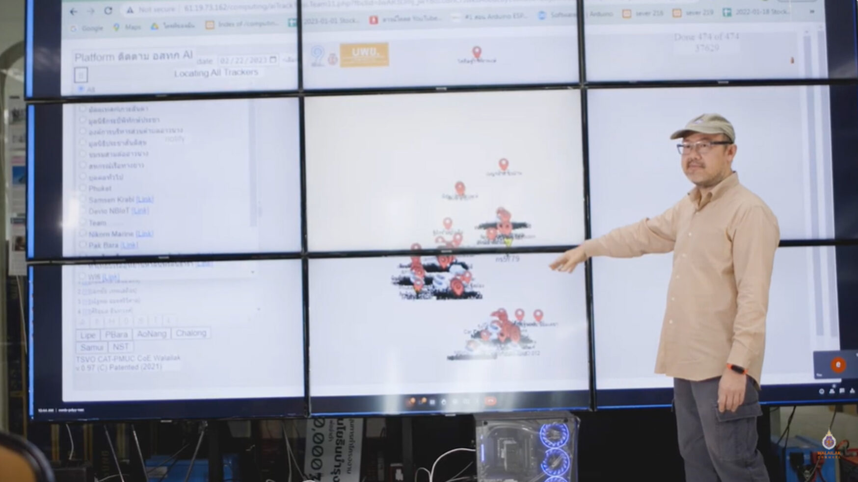
Boat Tracking System Using IOT for Marine Resource Security
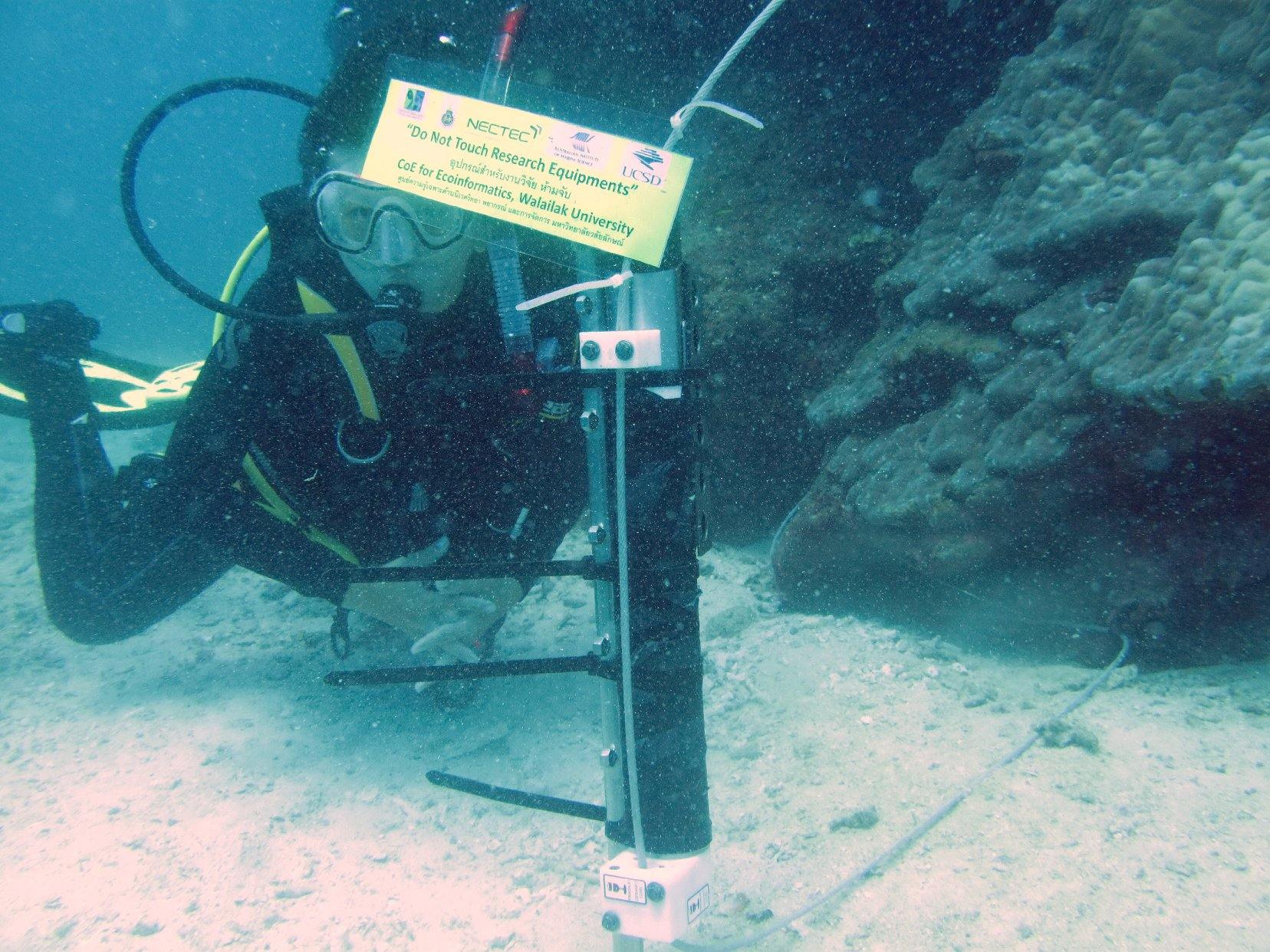
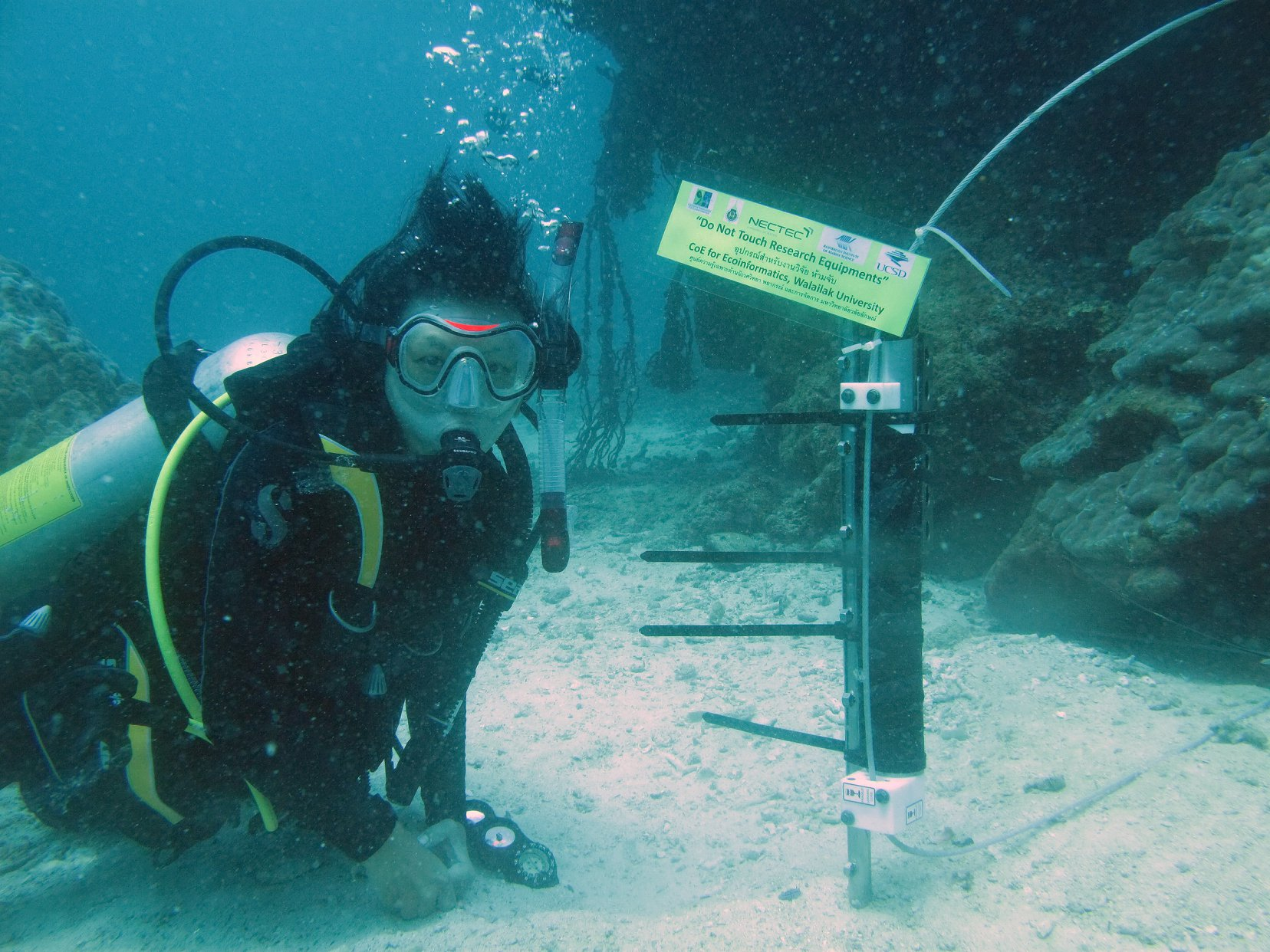
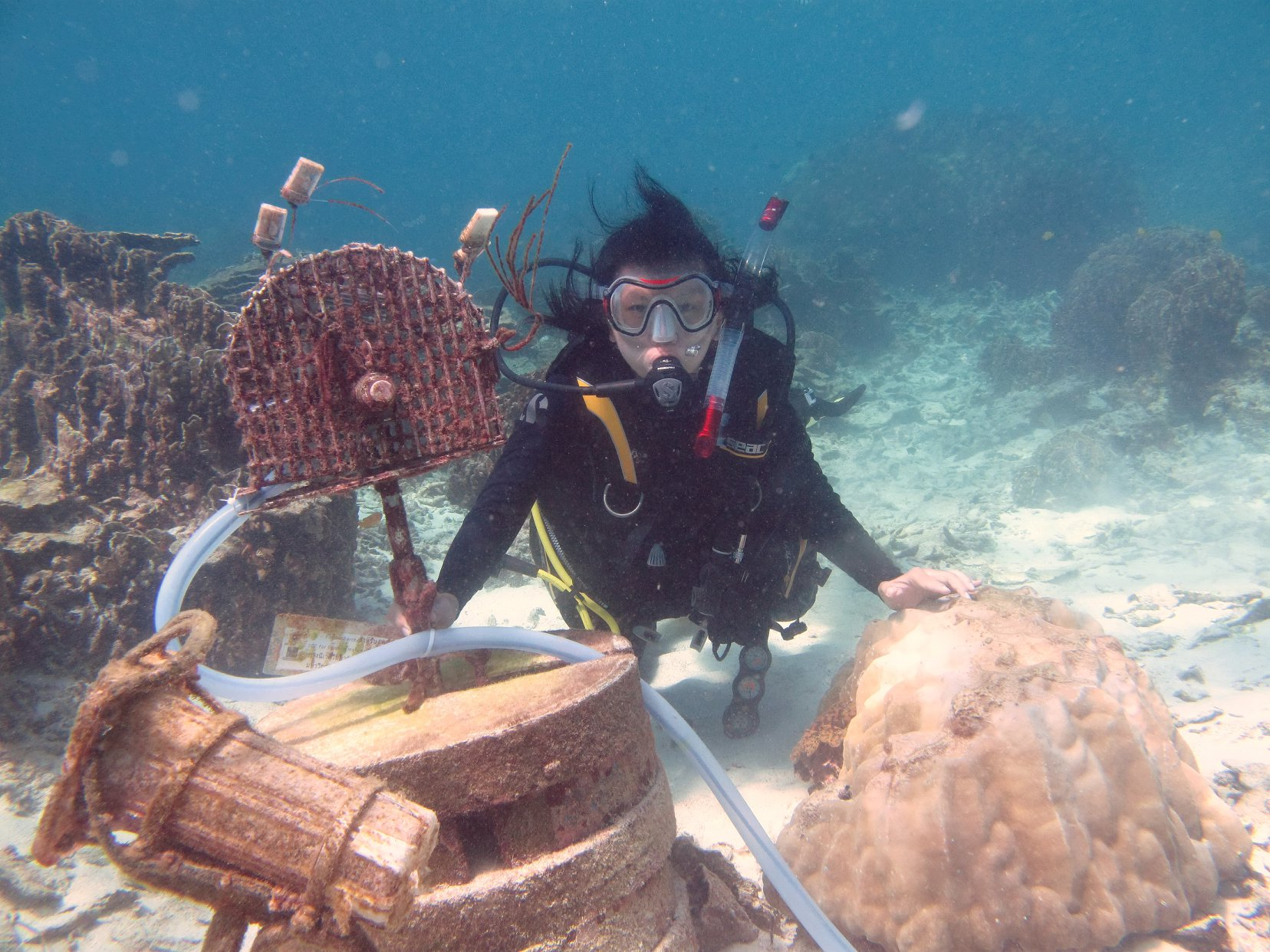
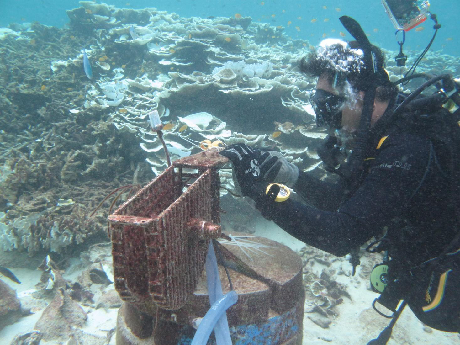
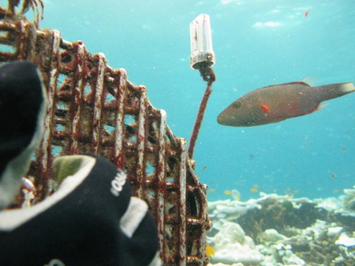
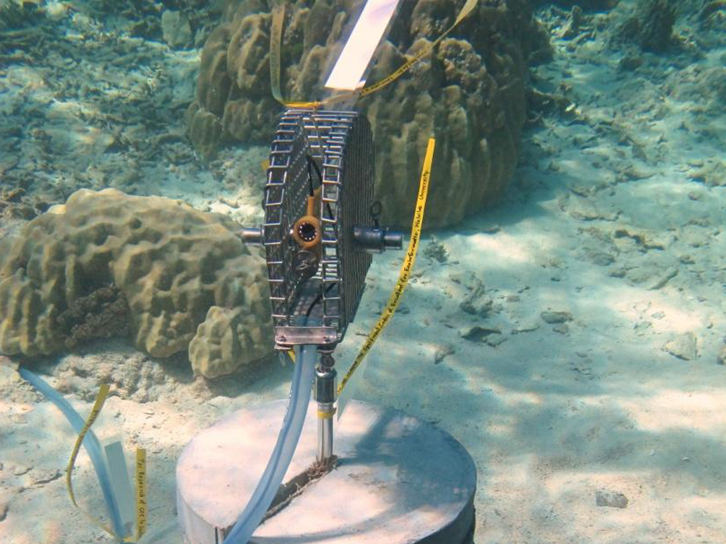
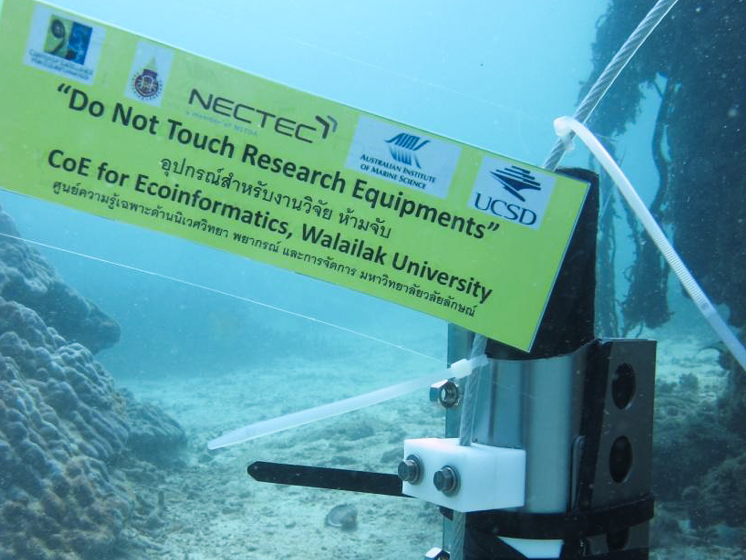
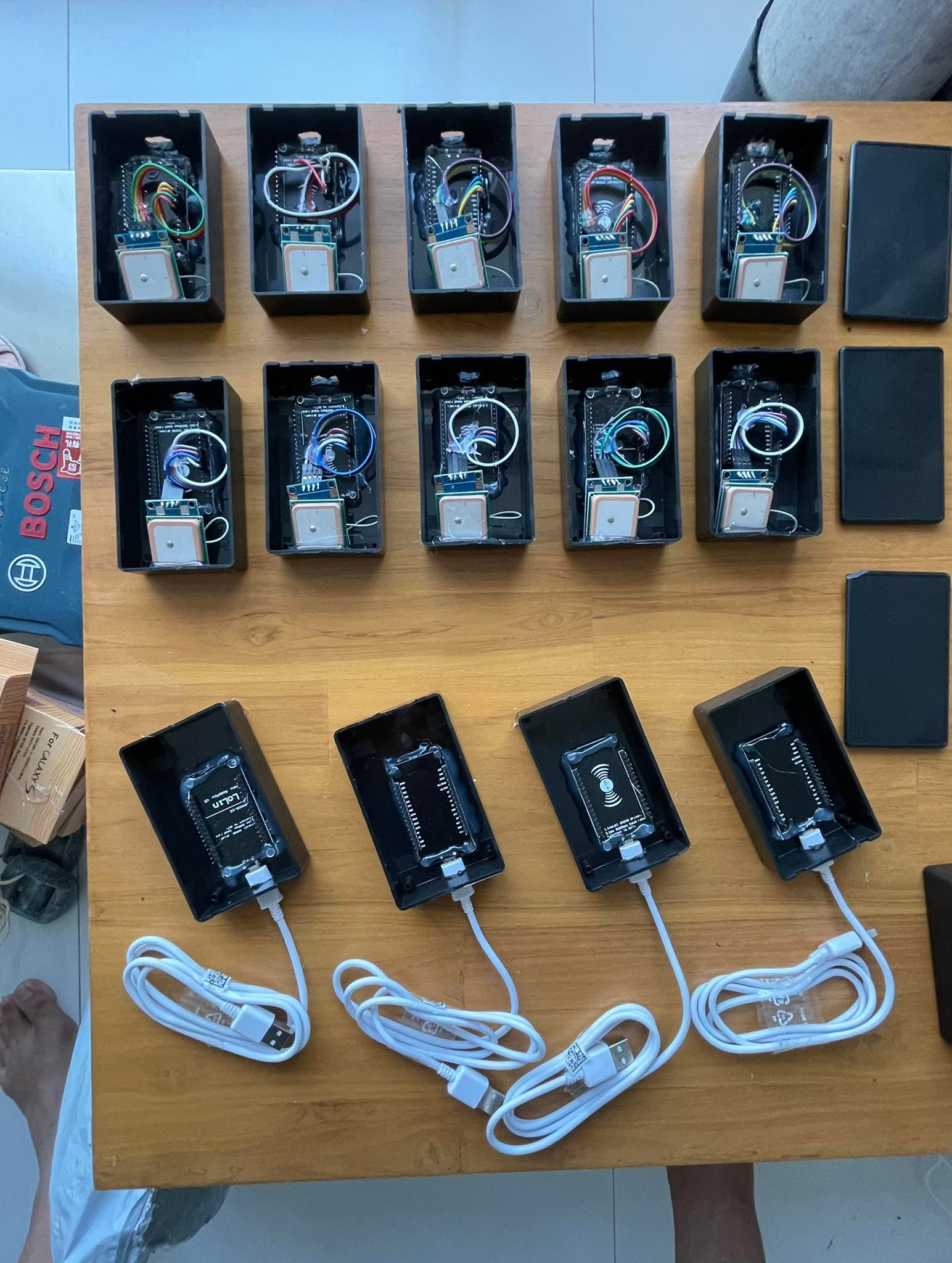
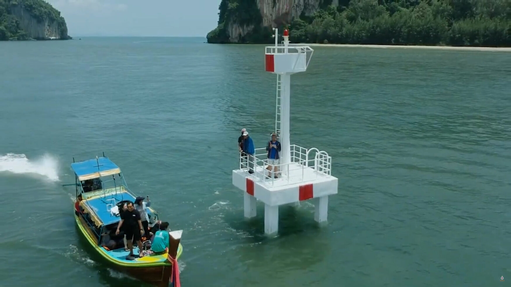
For more than a decade, Walailak University, through the dedicated work of Assoc. Prof. Dr. Krisanadej Jaroensutasinee and his research team, has been at the forefront of advancing marine environmental monitoring technologies. One of their landmark projects is the establishment of CTD (Conductivity, Temperature, and Depth) sensor networks, designed to observe and record environmental changes around coral ecosystems and support tsunami-related studies around Racha Island in Phuket Province.
These sensors, strategically installed in Khon Khae Bay and Patok Bay, continuously record variations in seawater temperature, conductivity, and depth. Over the years, the project has expanded its scope to monitor broader environmental parameters, providing valuable insights into the dynamic changes affecting coral reefs and marine biodiversity.
The real-time data collected from this CTD sensor network is crucial for effective environmental management. It not only helps researchers assess marine conditions but also serves as a scientific foundation for policymakers to design strategies to prevent coral reef degradation in Phuket and other coastal areas of Thailand.
Identifying Threats to Marine Resources
Assoc. Prof. Dr. Krisanadej Jaroensutasinee’s research revealed that sunk or abandoned boats are among the major causes of marine resource degradation. When a boat sinks, it can release oil, fuel, and hazardous chemicals into the sea, causing severe pollution. The debris can also crush coral reefs and seagrass beds, release toxic substances from paints or batteries, and create navigation hazards for other vessels.
A notable example in Thailand was the HTMS Sukhothai (FS-442) incident, which sank on 18 December 2022 in the Gulf of Thailand. The ship released fuel into surrounding waters, affecting marine organisms and habitats near the corvette’s sinking site. Such incidents emphasize the urgent need for innovative technologies to enhance marine safety and prevent environmental disasters.
IoT-Enhanced CTD Network for Boat Tracking
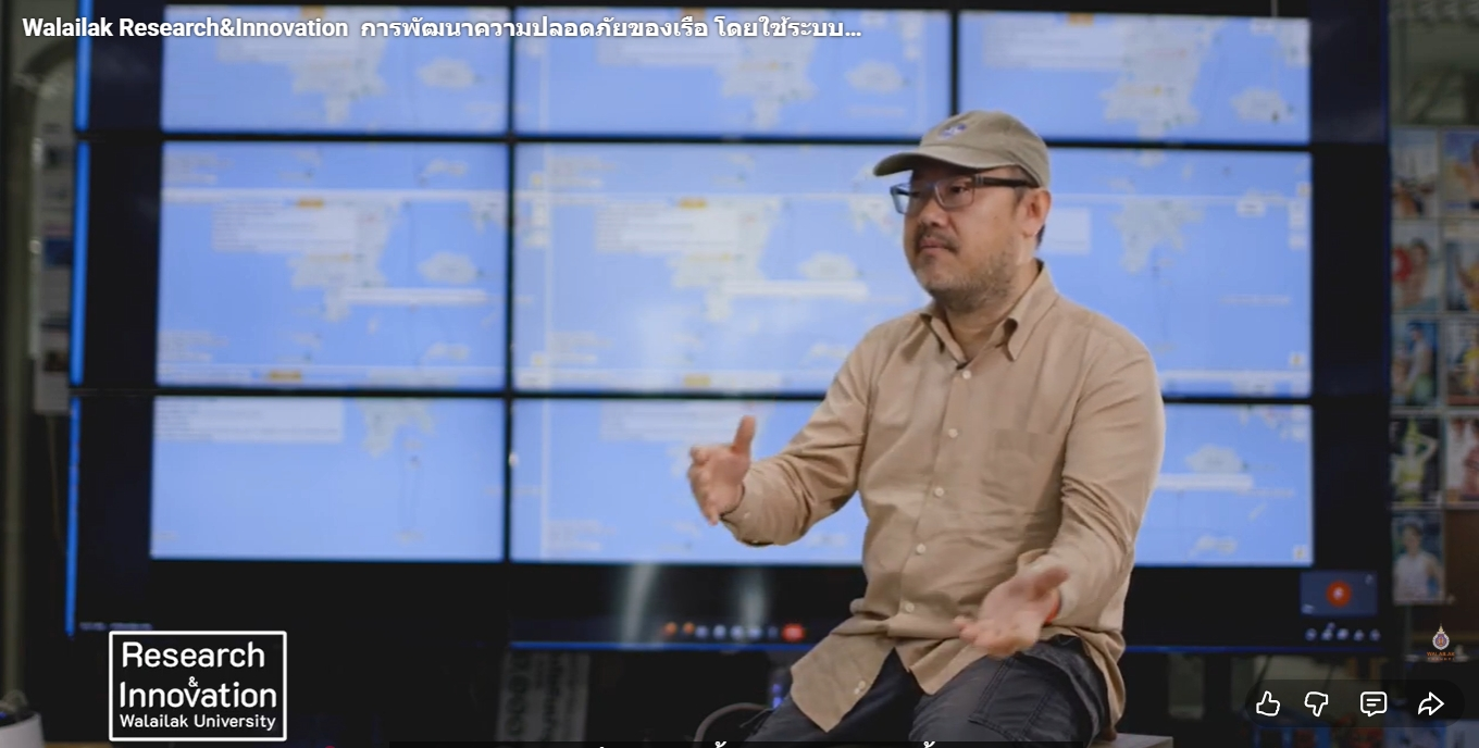
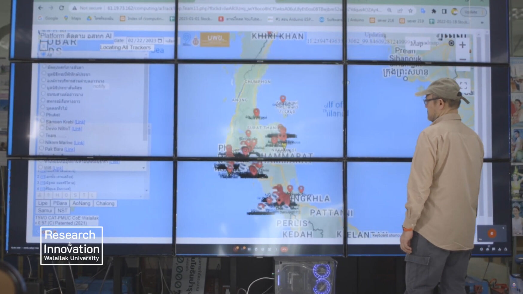
In response to these challenges, in 2024, Assoc. Prof. Dr. Krisanadej Jaroensutasinee and his research team collaborated with CAT Telecom Public Company Limited, NICAL MARINE CO., LTD., and PLUG N PLAY CO., LTD. to expand the CTD sensor network into a smart boat tracking system using the Internet of Things (IoT).
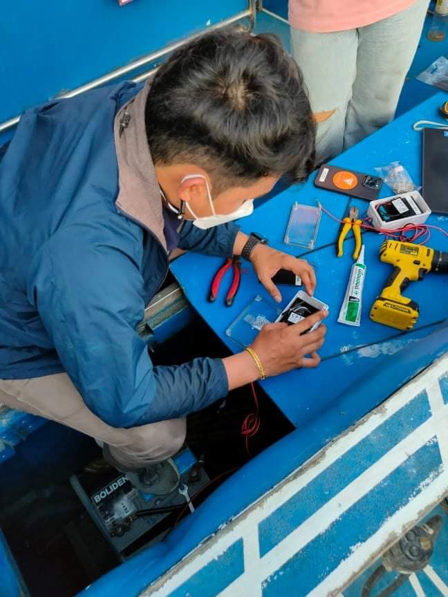
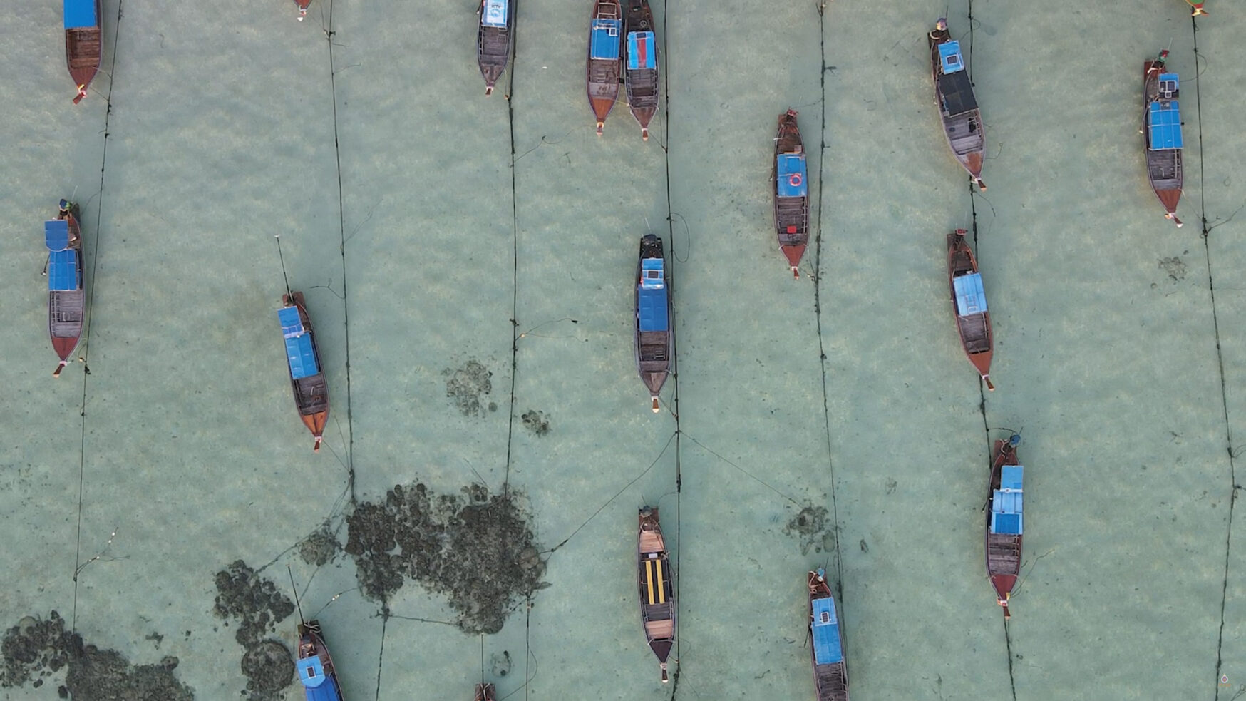
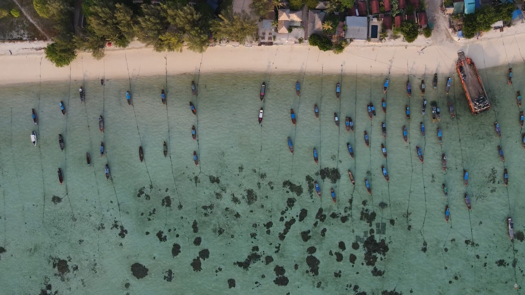
The project focused on developing a monitoring system capable of tracking boat movements and conditions around Phuket, Krabi, and Satun Provinces. During the initial phase, a test was conducted along the coasts of Racha Island to evaluate the range and capacity of the sensors. The test demonstrated that the island-based data hubs could efficiently receive and transmit all collected data in real time.
The upgraded system integrates IoT with the existing underwater CTD network, enabling real-time boat tracking and communication between island-based users and vessels at sea. This innovation also introduced an alternative telecommunication channel between island communities and boat crews, particularly useful in emergencies when conventional phone communication is unavailable—such as when crews are busy fishing, diving, or attending to tourists.
Technological Process and Smart Features
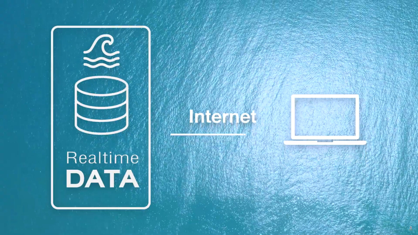
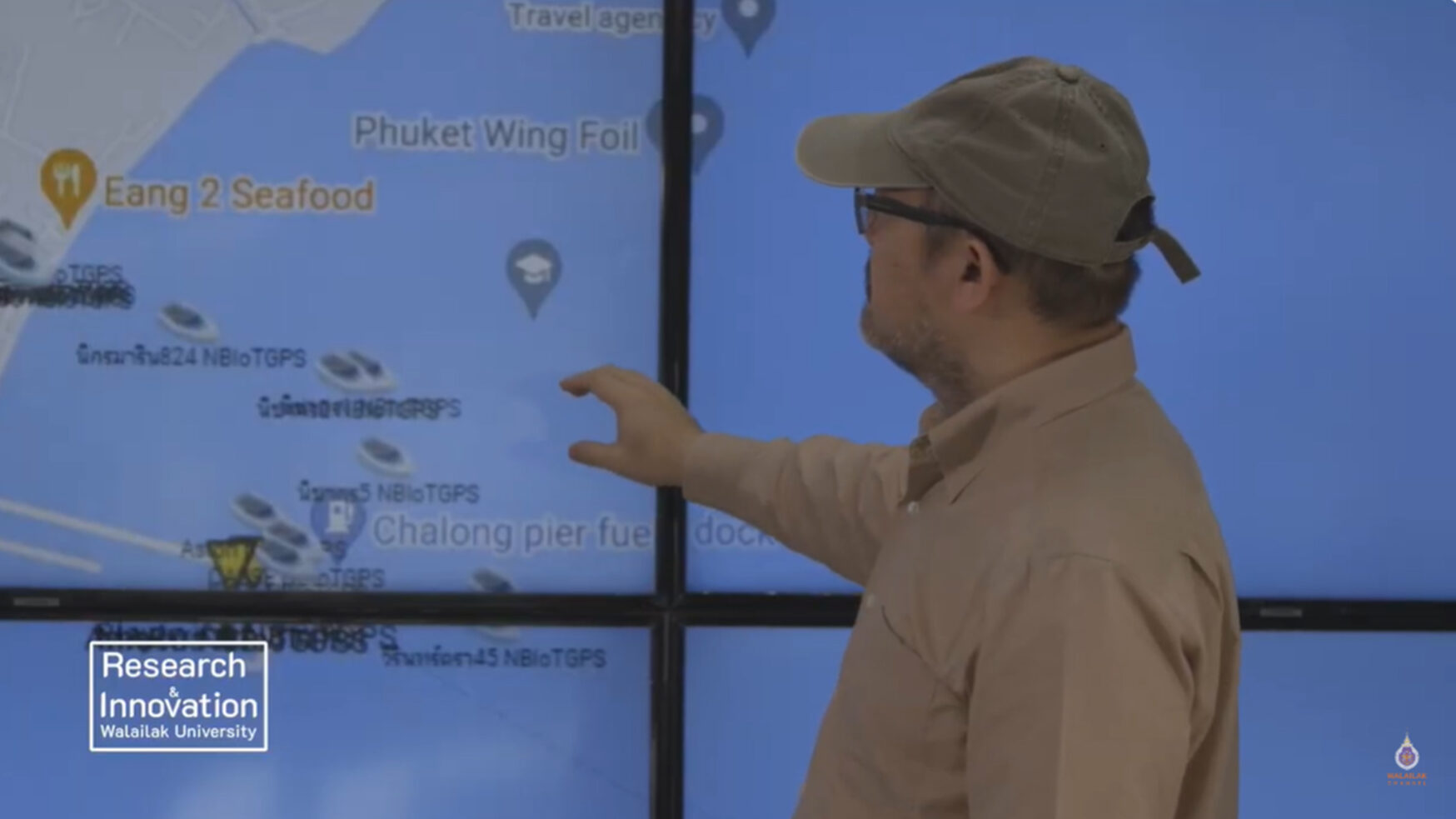
The system functions by collecting environmental and navigational data from the CTD sensors, which is then transmitted via underwater cables to data centers on the islands. From there, the information is sent over the internet to user devices.
Using machine learning and artificial intelligence (AI) algorithms, the system processes and analyzes data to calculate the positions, routes, and movement patterns of vessels. The smart interface allows users to view boat locations, forecast movement directions, and receive data on vessel conditions in real time.
The system’s cloud storage integration ensures that all data is securely archived and recoverable, preventing data loss and enabling long-term analysis.
Testing showed that the upgraded IoT-based CTD network could effectively track between 50 and 400 boats simultaneously. Users can monitor ongoing routes, predict boat directions, access real-time condition updates, and communicate with crews instantly.
The system provides a critical layer of marine safety, significantly reducing the risk of accidents and shipwrecks. When emergencies occur, the system enables immediate communication between island stations and boats, facilitating faster response times and rescue coordination.
Beyond improving navigation safety, this innovation plays a crucial role in protecting marine ecosystems. By reducing the likelihood of shipwrecks and collisions, it minimizes potential damage to coral reefs, seagrass meadows, and other sensitive habitats. The real-time data also allows authorities to identify high-risk zones, implement restricted navigation areas, and prevent unauthorized activities, such as illegal fishing or coral harvesting.
Moreover, the system contributes to sustainable marine industry practices, enabling companies and government agencies to monitor maritime activities responsibly. By combining IoT, AI, and marine science, the project represents a model for technology-driven environmental conservation.
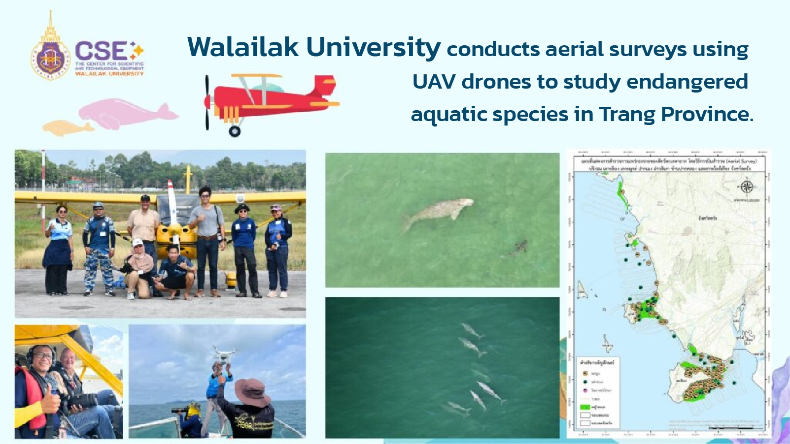
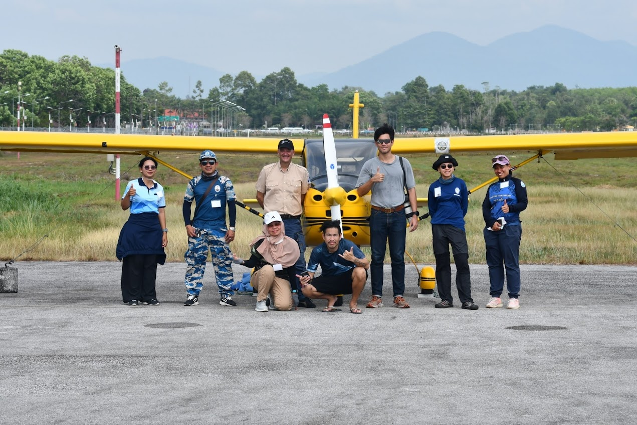
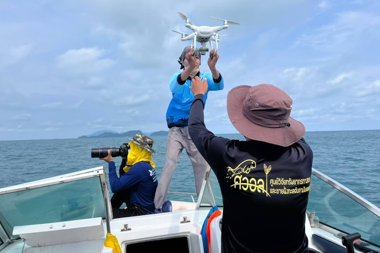
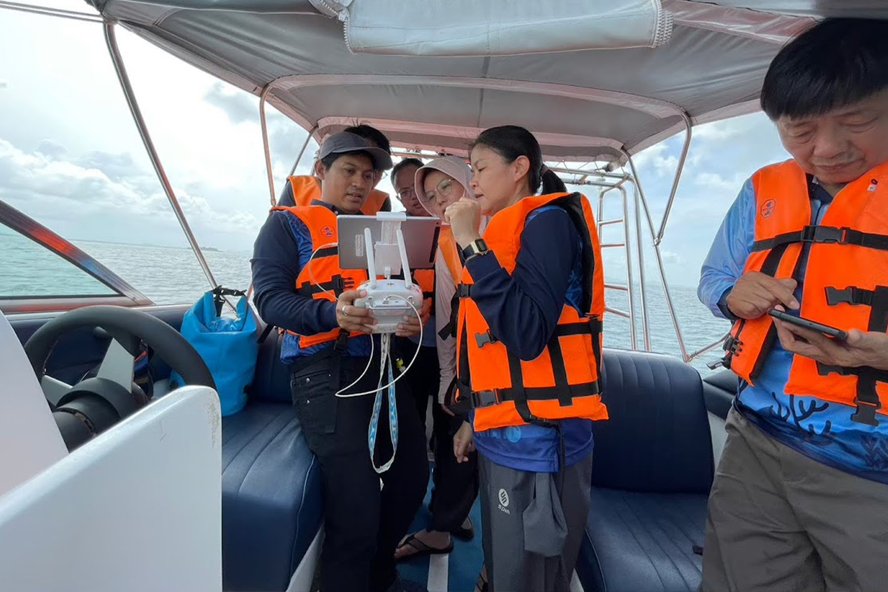
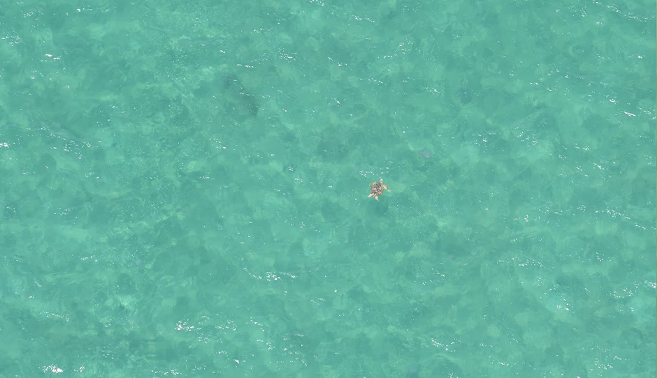
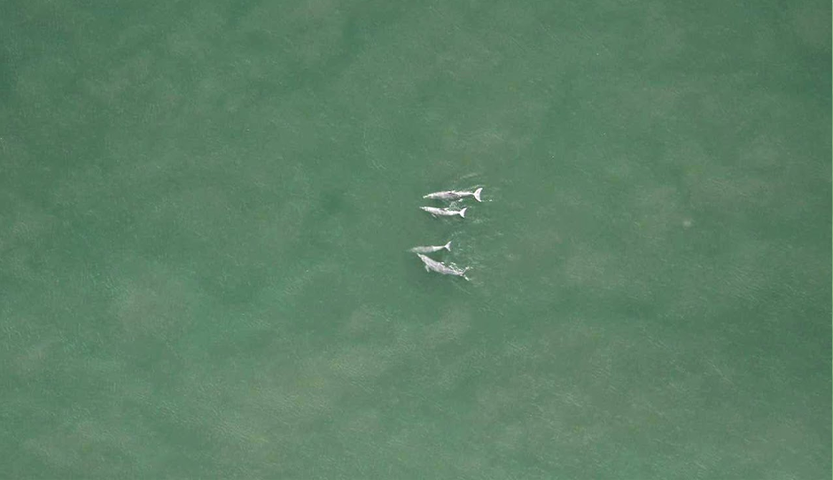
Aerial Survey Using UAV-Drone for Exploring the Abundance of Marine Animals
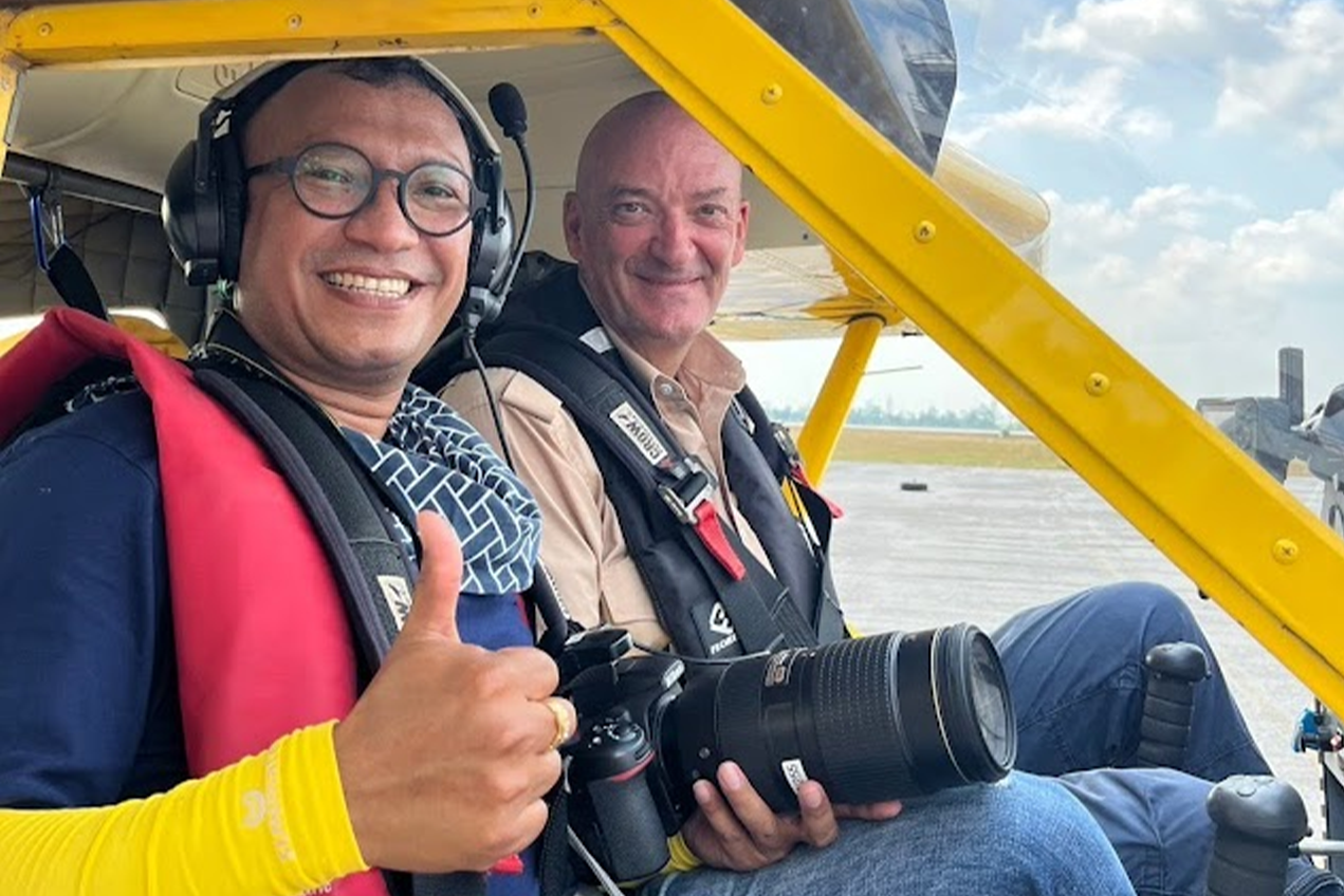
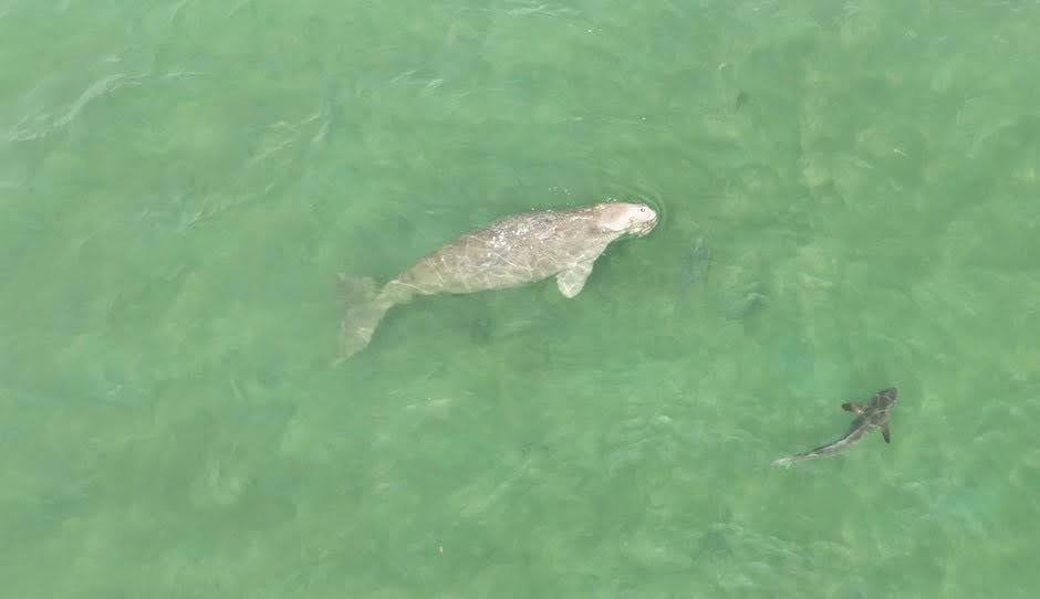
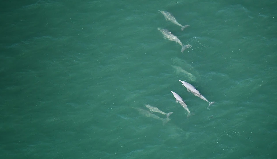
Walailak University conducted comprehensive aerial and marine surveys to study and conserve rare marine species along the coast of Trang Province. The research team employed a two-seater fixed-wing aircraft to perform line transect surveys, in collaboration with volunteer pilot Mr. Eduardo Angelo Loigorri, enabling the collection of high-resolution data across extensive marine zones. Complementing the aerial survey, unmanned aerial vehicles (UAV-drones) were deployed to monitor marine habitats around Libong Island, Muk Island, and the neighboring seagrass meadows, ensuring complete coverage of the province’s coastal ecosystems.
Preliminary findings revealed a rich diversity of marine megafauna, including 36 dugongs (with one mother-calf pair), 6 humpback dolphins (including two mother-calf pairs), and 38 sea turtles. Visual health assessments showed that dugongs exhibited normal feeding and movement behaviors within the seagrass beds, indicating a healthy and stable population. The presence of mother-calf pairs further signifies successful breeding and favorable ecological conditions. Likewise, the humpback dolphins appeared robust and free from injuries or entanglement by fishing gear, while sea turtles showed no signs of stress or abnormal activity.
Overall, these innovative technological initiatives underscore Walailak University’s strong commitment to protecting and restoring aquatic ecosystems through science-based, data-driven solutions. By integrating GIS, Remote Sensing, IoT, AI, and UAV-drone technologies, the university enhances environmental monitoring, promotes marine safety, and supports sustainable management of marine biodiversity. Collectively, these efforts not only strengthen ecosystem resilience and prevent environmental degradation but also serve as a model for advancing sustainable marine practices in Thailand and beyond.